Old Maps of the Island of Jersey |
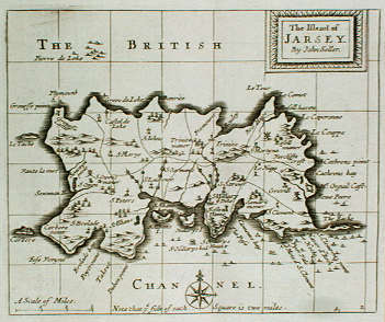
John Seller, 1701 |
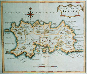
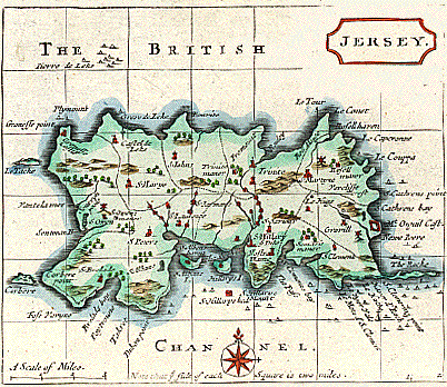
Thomas Osborne, 1748 |
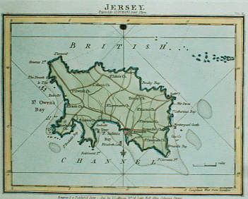
John Luffman, 1804 |
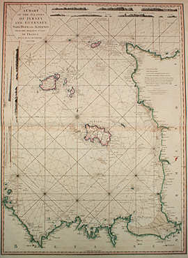
Louis D. d'Arcy Rochette, 1806 |
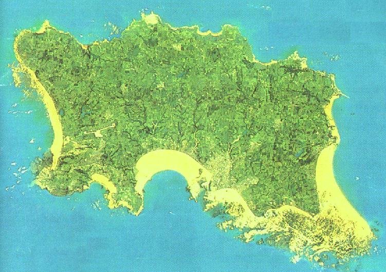
An Aerial Photograph |
| From Grose's The Antiquities of England and Wales, published 1777 |
 |
From Grose's The Antiquities of England and Wales, published 1777.
Jersey, Guernsey, Alderney and Sarke are all remnants of the ancient Duchy of Normandy, which country, under the Romans, was called Augia,
and was their second Provincia Lugdunensis, and under the kings of the Franks constituted a part of the kingdom of Neusiria. In nine hundred and twelve,
Charles the Simple, ceded it to the piratical Normans, as a fief of France, and Rollo - their leader was married to a daughter of the same king, William, the
sixth Duke of Normandy, became king of England, and (with the rest of his dominions) annexed these islands to the sovereignty of England, the only parts now
in our possession. They belong to Hampshire, and are in the diocese of Winchester.
ISLAND of JERSEY
Engraved by W. Hooper
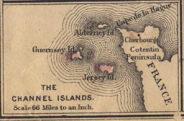
The first of these, Jersey, lies about fifteen miles west of the coast of France, or the Cape of La Hogue, and eighty four miles south of Portland, in
Dorsetshire. It was anciently called Caesaria, and here many Roman coins have been dug up, along with other antiquities; and there are yet the vestiges of a
Roman camp, near the Manor of Dilamant.
It is about twelve miles in length, and not above six broad, containing about thirty-six square miles. The number of its inhabitants is twenty thousand, having a
division of twelve parishes, with only eight churches. The chief towns are St. Helier, and St. Aubin; the former of which contains about four hundred houses,
and near two thousand inhabitants. The latter has a fort and harbour well defended. The Chateau de I'Islet, or Queen Elizabeth's Castle here, is reckoned the
best of fortifications belonging to Great Britain.
French is the language of the pulpit and bar, and it is generally spoken both here and in the neighbouring islands. Exclusive of the Roman antiquities, there are
many remains of Druidical temples still visible.
It is finely watered, abounds with fish, fruit, and cattle; makes excellent cider, has great variety of sea-fowl, the best of honey, fine wool, remarkably fine
butter, but labours under a scarcity of corn and fuel, for the latter of which they substitute vraic. Here are manufactured a peculiar kind of worsted stockings
much esteemed; nor are they without mineral springs of a purgative quality. Its intercourse with France, supplies it with wines, brandy, etc. very easily, so that
it has but little malt liquor. The partridges here are remarkable for having red feet, and among its fish is a remarkable sort called Ormer. They are governed by
the Norman laws, the courts of judicature in England having no jurisdiction over any of these Islands.
From Warren's A Brief Course in Geography
Published in Philadelphia by Cowperthwait & Co. in 1876 |
 |
| From Aaron Arrowsmith & Samuel Lewis, "A New and Elegant General Atlas. Comprising All the New Discoveries, to the Present Time", Boston 1805, engraved by Marshall |
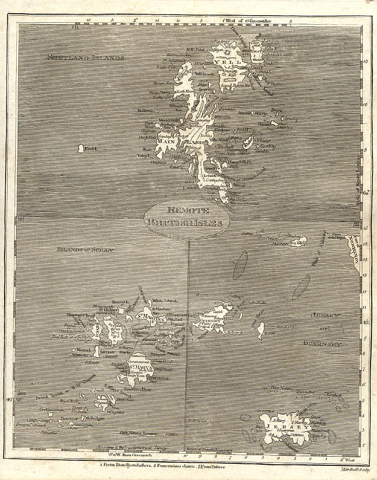 |
Aaron Arrowsmith (1750-1823) was a British geographer and cartographer who engraved and published many fine maps and atlases based on the best available sources of the day. Without a formal education Arrowsmith went to London c. 1770 and, after working as a surveyor, established himself as a mapmaker and publisher. His large world map (1790) established his reputation. A second such map published in 1794 was accompanied by an explanatory volume. Other notable works included a map of North America (1796), a chart of the Pacific Ocean (1798), and his Atlas of South India (1822). After Arrowsmith's death, the business was carried on by his sons, Aaron and Samuel, who published geography manuals and a number of atlases. From 1839 the business was conducted by his nephew, John Arrowsmith, himself an eminent cartographer, who published the London Atlas 4 vol. (1834), the best set of maps then in existence. This work was followed by a long series of elaborate and carefully executed maps embodying the results of contemporary exploration.
| This map by Mercator of the Islands of England was published in the 1595 Latin edition of Mercator's Atlas. |
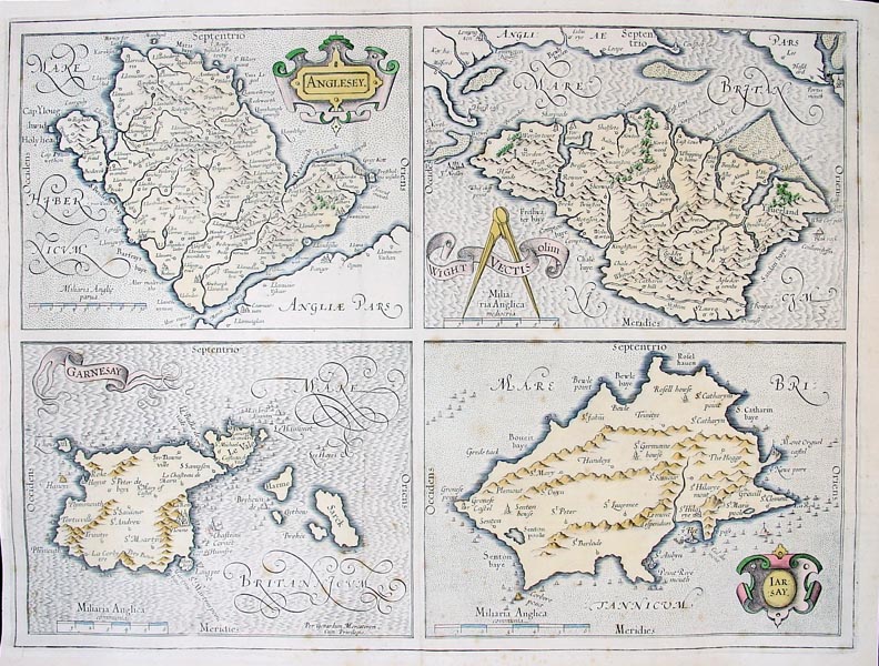 |
Map Title: Anglesey, Wight..., Garnesay, Jarsay.
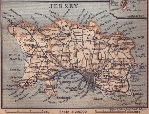
Bacon's Geographical Establishment
Published in London, circa 1880 |
 |
| Click here for 300 dpi image of this map |
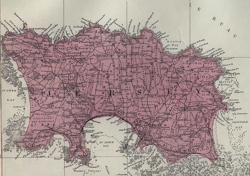
| Baedeker's Great Britain: Handbook for Travellers -
1897 |
 |
| Click here for 300 dpi image of this map |
Antique Maps Prints for Sale
goto
home,
tokens,
1/12th of a shilling,
1/13th of a shilling,
decimal,
one pound,
commemoratives, or
gold coins